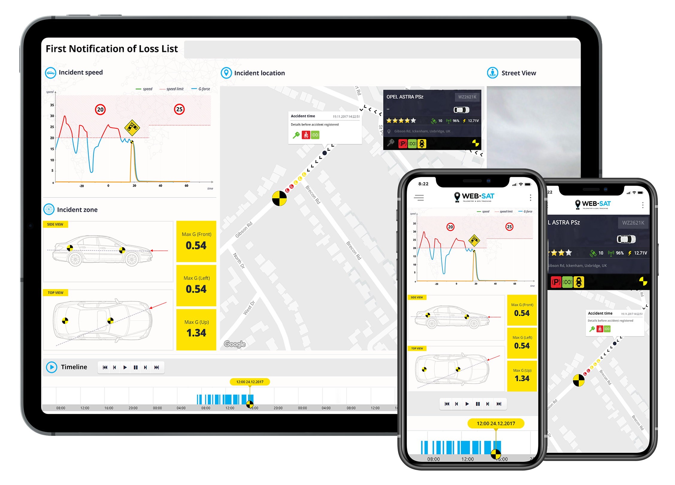
Use the live timeline panel with Google Street View 20-second cycle of detailed analysis
Precise data driven by:
GPS
3D Accelerometer
Google Maps with road speed limits, satellite and street view
CAN Data
Crash Analysis Tools
The CAT application allows one to analyze a road accident with high precision. CAT presents data ranging from 10 seconds before to 10 seconds after the road accident.
CAT Give every user instant access to the smart timeline panel with Google Street View, impact data, force directions and more.
Accident data is stored on the cloud and available from any computer with internet access.
At the time of the accident, data is automatically sent to the Crash Analysis Tool server. AI analysis allows for easy reconstruction of the accident
Telematics devices with the BlackBox feature allow recording of data with a very high frequency. Data is stored in the cache in the time loop, which contains all the parameters.
 GPS
GPS